
Expertise in LiDAR Laser 3D Data Collection and Processing - Accurate, Complete, and Photorealistic 3D Images
Enhance your 3D mapping and surveying capabilities with our Lidar Point Cloud services. Utilizing state-of-the-art FARO scanners, we create accurate, complete, and photorealistic images of any environment or object, providing precise measurements and insights for your project needs.
Experience accurate measurement capture for any space with our cutting-edge technology.
Expert LiDAR Point Cloud Services:
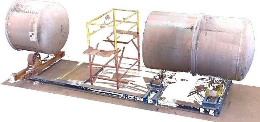
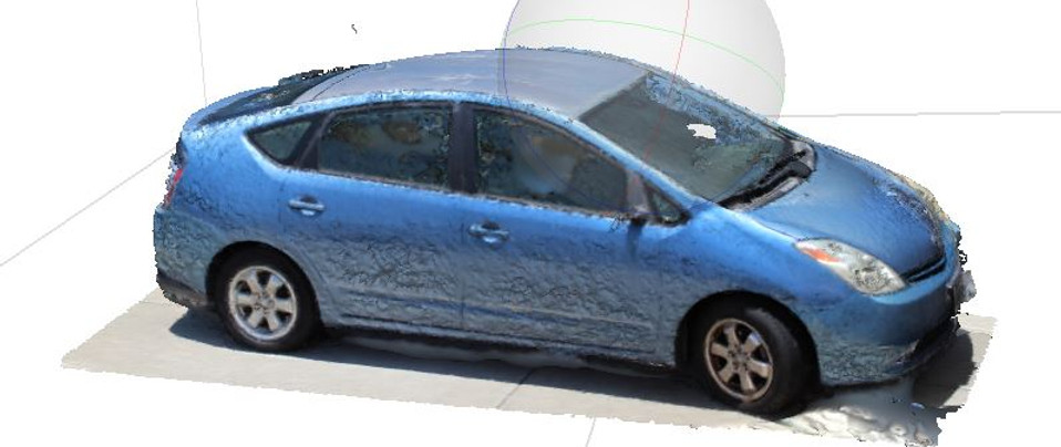
We offer 3D LiDAR point cloud captures with a range of 70m and 150 m. Examples of LiDAR scanner collection include:
Our team specializes in providing high-quality 3D LiDAR point cloud captures with a range of 70m and 150m. We have extensive experience in capturing data for various applications, including large laboratory equipment, architectural facades, construction sites, complex structures, production and supply facilities, and the evaluation of damaged cars, trucks, and equipment. Contact us today to learn how we can support your project with our LiDAR point cloud services
Orthoimages for construction and mapping
Our reality capture services provide value for your construction or repair project at each phase: planning, design, and construction. 3D CAD models of the site give architects, engineers, and construction professionals the ability to provide the best possible service. We deliver custom LiDAR collection services, ranging from raw point cloud data to custom CAD models.
Our areal photogrammetry services represent reality for powerful 3D visualization while providing geospatial information for accurate mapping. They are used to create:
-
orthoimages
-
3D plans
-
3D models
Point clouds can be integrated into almost any CAD platform to perform standard fieldwork while at the convenience of a desk.

Unlock the power of AI with high-quality point cloud data
Our LiDAR point cloud segmentation services provide an accurate and efficient classification of point clouds into different regions, making it possible to analyze and understand the 3D structure of a scene.
Our expert team utilizes advanced techniques for 3D point cloud segmentation, including X, Y, and Z coordinates as well as other optical properties such as reflectance and color, to achieve high-quality results.
We also provide multiple scan position registration, or stitching, to create comprehensive point clouds of an entire scene.
With our services, you can overcome the challenges of high redundancy, uneven sampling density, and lack of explicitly labeled structure of point cloud data. Our segmentation process is a fundamental step in processing 3D point clouds and is essential for various applications such as object recognition and scene understanding
FAQ and a few answers
Optimizing 3D Point Cloud Segmentation for AI

Maximize the accuracy and efficiency of your 3D point cloud segmentation with our expert data collection and preparation services. Our team specializes in identifying and classifying objects within point clouds through thorough data collection, cleaning, and labeling techniques. Trust us to prepare your data for optimal performance in your AI module.