Custom AI vision models
Object detection, segmentation, classification and anomaly localization — trained and validated on your data.
Thermal, sonar, LiDAR, SWIR, endoscopy, microscopy — and ordinary video too. We take your data and give you a working prototype in weeks.
“In just six short weeks, I am now testing my prototype.” — Founder, StrikeSure
We break a hard vision problem into solvable AI tasks, then build the models, pipelines and apps that run them.
Object detection, segmentation, classification and anomaly localization — trained and validated on your data.
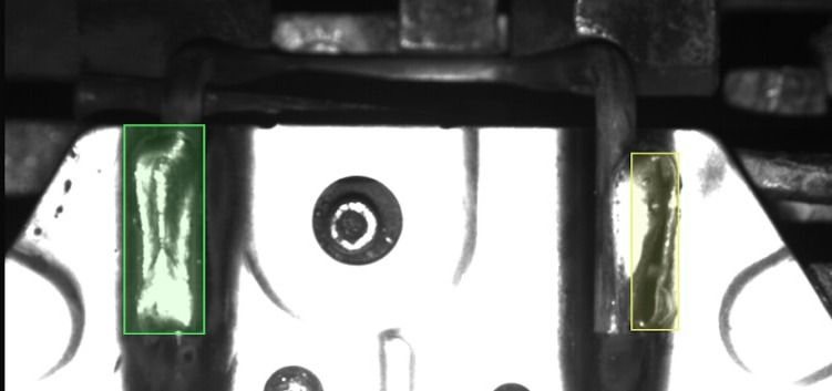
Defect detection for manufacturing and maintenance: connectors, coatings, curing, wear, fabric and more.
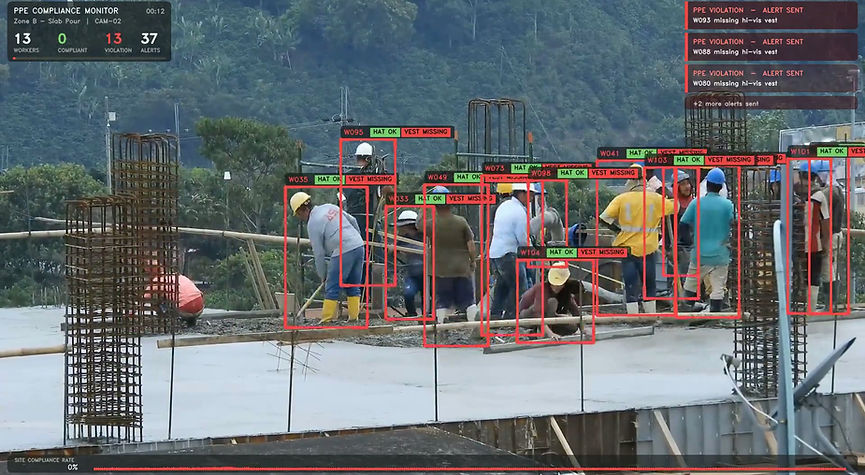
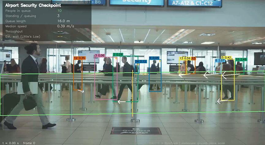
Real-time monitoring from cameras you already own: PPE compliance, queues and crowd flow, fire and smoke, incident review.
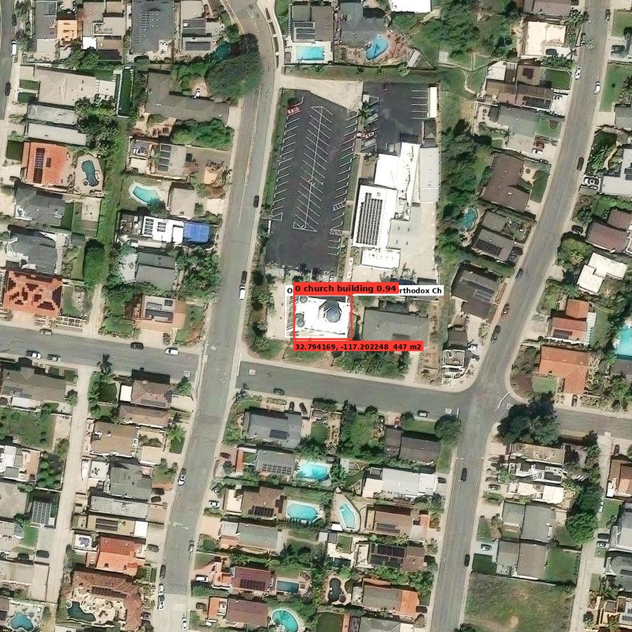
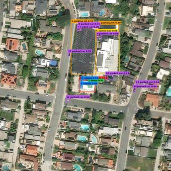
Georeferenced detection in aerial imagery, photogrammetry and 3D models, LiDAR point-cloud processing.
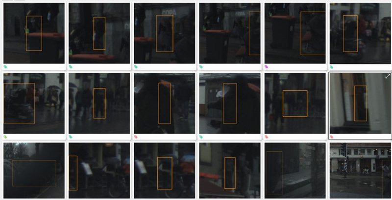
Sensor data capture, annotation, augmentation and dataset quality audits, so your models learn from the right data.
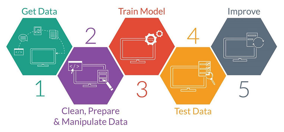
Feasibility and architecture reviews, patent strategy and drafting, and SBIR/DoD proposal support.
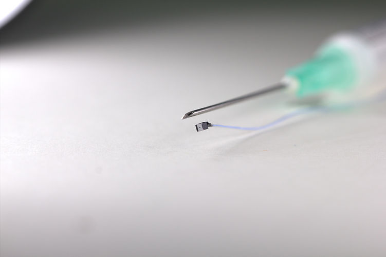
Image quality, anomaly localization and device-side AI.
Explore →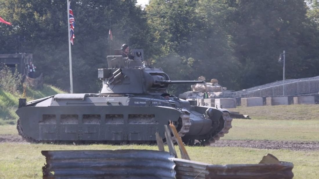
Sonar, thermal and aerial detection, SBIR support.
Explore →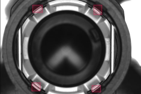
In-line defect detection and inspection automation.
Explore →
Georeferenced detection, photogrammetry, 3D models.
Explore →A sample of the systems we've delivered for industry, infrastructure, healthcare and startups.
Demo video · tap to play
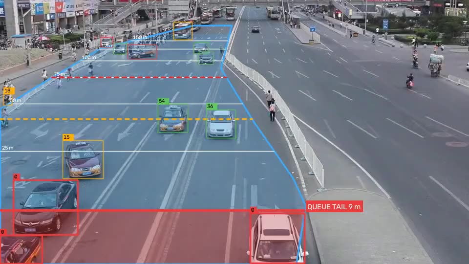
Useful for: traffic management centers, highway operators, work zones, and junctions where queues cause crashes or gridlock.
 Drones & geospatial
Construction safety
 Operations
“I hired IPD to help with my AI Vision System, StrikeSure. In just six short weeks, I am now testing my prototype and building a custom Computer Vision System Algorithm.”
“Working with Iryna and the IPD Scientific team was an exceptional experience… Their expertise in AI-based image processing and real-time detection helped transform our early concept into a working prototype.”
“Iryna's background in computer vision for cameras let her effortlessly understand our challenges and what it would take to address them with AI.”
“IPD is not only a leading-edge firm in the field of machine learning and advanced imaging, they are a pleasure to work with.”
Start from something that already works. Each one comes with annotated video, a data file and a dashboard, and we tune it on your own footage.
Real demoChecks hard hats and hi-vis vests on the cameras you already have. Sends a photo alert with the zone and time only when a violation is confirmed, plus an end-of-shift compliance report.
See how it works →Real demoHead count, queue length, walking speed, people per minute, estimated wait, dwell time and a density heat map, from one fixed camera.
See how it works →Real demoWatches a defined stretch of road or highway and detects when traffic starts to back up: where the queue starts and ends, how long it is, and how fast it moves. Alerts when a queue forms, for work zones, incidents and traffic operations.
See how it works →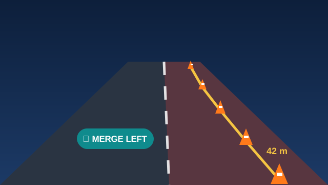 Illustration
Finds the cones, draws the merge line through them, shades the closed lane and shows the merge direction and distance to the taper in meters. Works from shape alone, even on black-and-white video.
See how it works →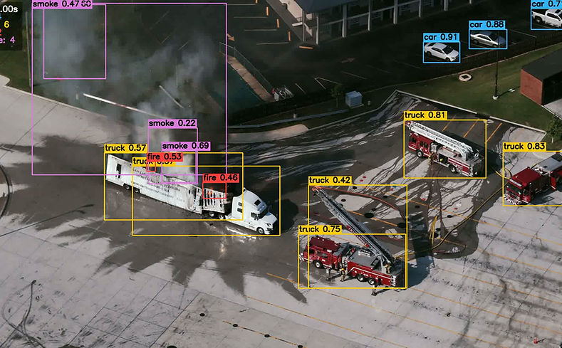 Real demo
Several detectors run on every frame and merge into one result: cars, trucks, fire and smoke. Returns annotated video plus a frame-by-frame data file you can search.
See how it works →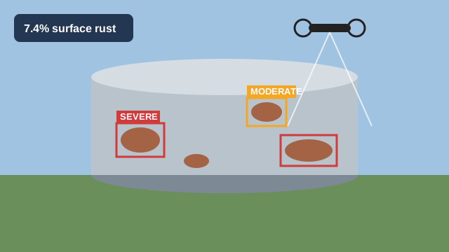 Illustration
Finds rust on large assets from drone imagery, grades how severe it is and measures the percent of surface affected, so repairs can be planned.
See how it works →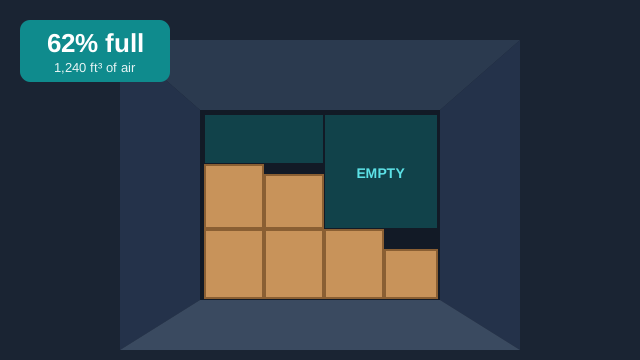 Illustration
A camera at the dock door measures how full each outgoing trailer is: fill percentage, wasted cubic feet and the cost of shipping air per load.
See how it works →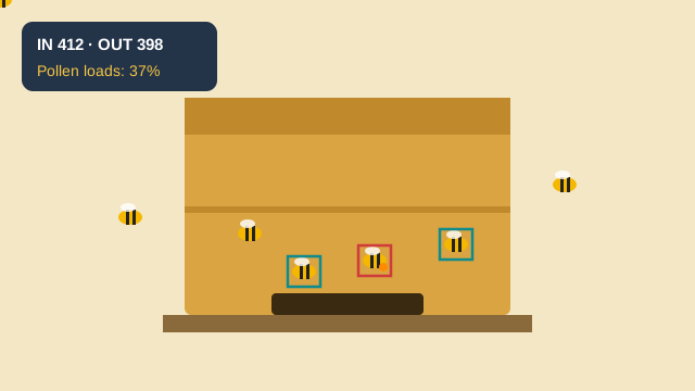 Illustration
Counts bees going in and out of the hive, spots pollen loads and tracks the drone-to-worker ratio, to show colony health for commercial pollination.
See how it works →That's exactly what the free 15 minutes are for. Bring a photo, a short video clip or just a description — we'll tell you honestly whether it's worth building, and what a sensible first step would be.
No surprises: here is every step from the first call to a working system. You decide at each step whether to go on.
You tell us what you need to detect or measure. We tell you honestly whether computer vision can do it, and which approach we'd use.
We sign your NDA. You share a few images or a short clip — or we come on site in San Diego County and collect a sample with our own sensors.
Scope, price and timeline for the first step: a fixed-scope feasibility study. You only commit to that step.
Feasibility, prototype, then production. Each phase has a clear end point, and you can stop after any of them.
Most clients start with a feasibility study, so nobody commits to a build that the data can't support.
Typically 2–3 weeks
Typically 6–10 weeks
Scoped per project
Ordinary photos are easy. We work across the spectrum — and we own and operate the equipment. Tap a sensor to see what we do with it.

Iryna founded IPD Scientific in 2022 and leads every project personally. She has 10+ years of experience building AI vision systems in Python, PyTorch, TensorFlow and MATLAB, across electro-optical, multispectral, thermal, sonar, LiDAR, microscopy and medical imagery — from first feasibility study through deployment, including real-time edge deployment with CUDA, TensorRT and ONNX.
Before IPD Scientific she was a Principal Investigator at the U.S. Navy's NAVWAR and later a Senior Data Scientist building 3D imaging systems in private industry. She is a co-inventor on 2 granted U.S. patents and a published patent application, all from her U.S. Navy research, has published peer-reviewed research (Springer) on deep learning for sonar imagery, and mentors as a SCORE advisor and science fair judge.
Connect with Iryna on LinkedIn →
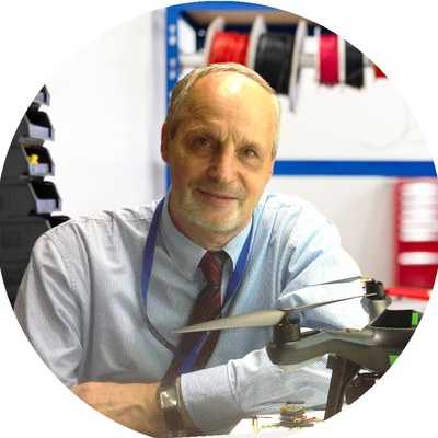
Senior Consultant — Optics, Electronics & Radar
20+ years in high-speed electronics, electro-optics and RF/microwave design. 10 U.S. patents and 200+ publications; author of the books Seeing Invisible: Advanced Antenna Arrays (2024) and Artificial Insect-Inspired Vision for Autonomous Systems (2025) — buy the books. He leads the antenna and radar inventions available for license.
Pavlo has been Principal Investigator on U.S. Navy, Air Force and DoD research programs as a Senior Scientist at AETHER, AMPAC and Compass Systems, and developed new passive-radar, tracking and imaging concepts as Principal Scientist at Planar Monolithics Industries. Earlier he was Head of Department and Vice-Dean at Vinnitsa National Technical University.
What we've learned building these systems, with real numbers.
Every project starts with a small, fixed-scope feasibility study, so you know what you are paying for before anything bigger. After the free 15-minute call we give you a price for that first step. Larger prototypes and production systems are quoted phase by phase.
A feasibility study typically takes 2–3 weeks. A working prototype on your own footage typically takes 6–10 weeks. Production deployment is scoped per project.
Often not. We start with the cameras and footage you already have. If a different sensor would work better, we own and operate thermal, SWIR, multispectral, LiDAR and other equipment, so we can test it before you buy anything.
Yes. We are happy to sign your NDA before you share any images, video or other data.
No. We are based in University City, San Diego, and work with clients across the United States. For projects in San Diego County we can also come on site to collect data with our own equipment.
Yes. We help companies choose sensors, define technical requirements and write the AI and computer vision parts of SBIR and DoD proposals.
You tell us what you need to detect or measure, and you can send a photo or a short clip beforehand. We tell you honestly whether computer vision can do it, which sensor and approach we would use, and what a sensible first step would be.
IPD Scientific is based in University City (UTC), near UC San Diego, Sorrento Valley and Torrey Pines. We work with San Diego defense, biotech, medical device, manufacturing and drone companies, and with clients across the United States.
Because we own and operate our own sensors, we can come to your site anywhere in San Diego County, from La Jolla and Carlsbad to Point Loma and Chula Vista, to collect thermal, SWIR, multispectral, LiDAR or drone data for your project.
IPD Scientific, LLC
8910 University Center Lane, Suite 400
San Diego, CA 92122
858-800-2430 · [email protected]
Email a photo or a short clip, or fill in the form, and Iryna will reply personally with an honest first take on whether computer vision can do it. Prefer to talk? Pick a 15-minute slot below.
You'll get a confirmation and a calendar invite by email.
Only name, email and the problem are required. Iryna reads every message herself.